Forest fires in Indonesia are closely linked to deforestation
A recent study from LEAF researchers at the University of Leeds found a strong relationship between forest cover loss and the occurrence of fire in Indonesia.
Across Indonesia, extensive forest and peatland fires occur every year. Indonesia contains most of the world’s tropical peatlands which are made of partially decayed vegetation that has accumulated over thousands of years. If peatlands dry out, fire can burn deep into peat soils adding large volumes of greenhouse gases to the atmosphere and contributing to climate change. Smoke from the fires leads to poor air quality and impacts human health. The fires also destroy important habitats for Indonesia’s unique wildlife.
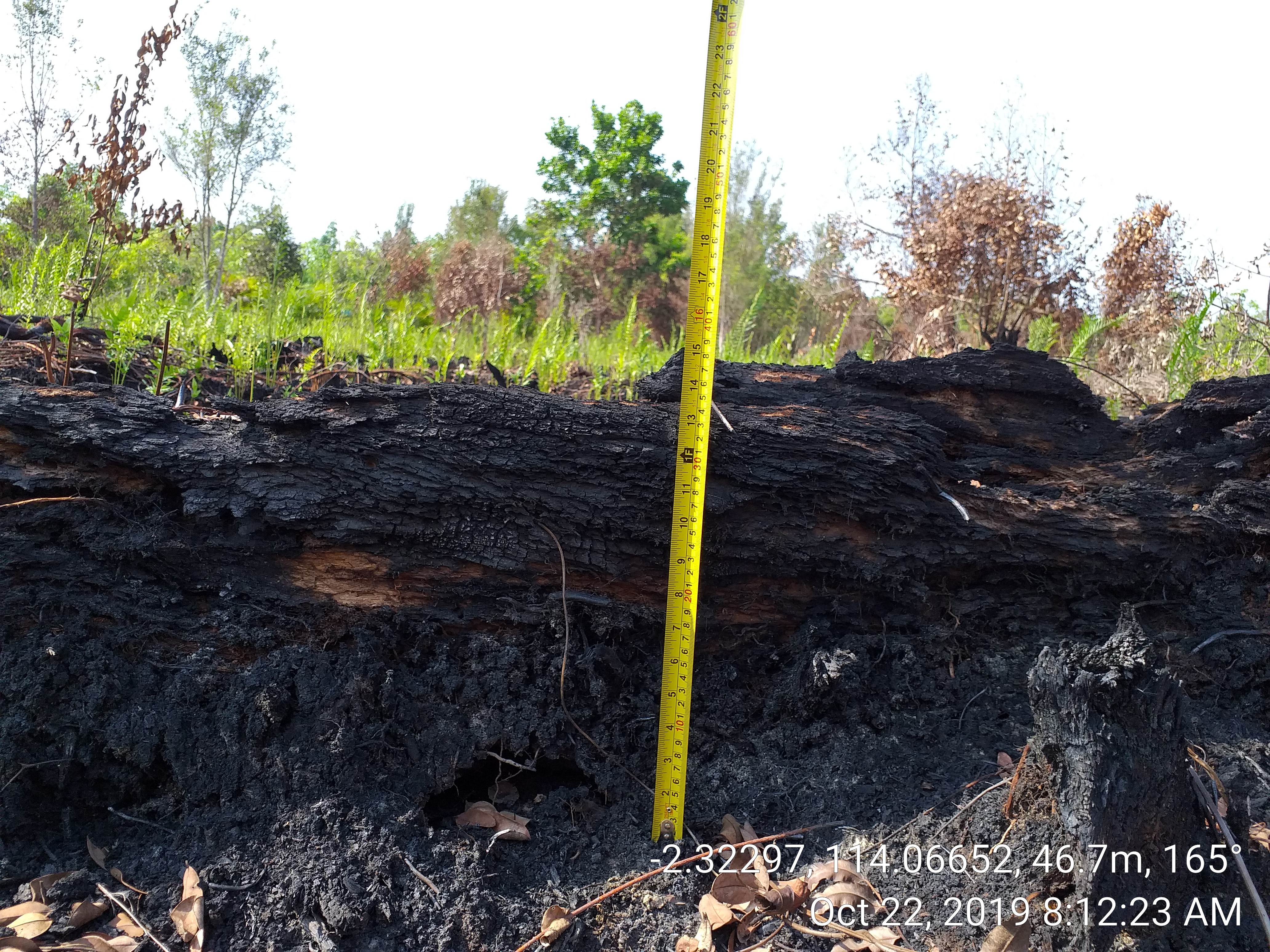
Depth of burn into peatland soils following forest fire. Photo courtesy of Muh Taufik.
Historically, forest and peatland fires were quite rare in Indonesia. Peatlands are naturally saturated with water and very difficult to burn. Forest clearance and drainage of peatlands during the establishment of oil palm and timber plantations dries out the peatland and makes it vulnerable to fires. The study aimed to understand the role of land cover change in Indonesian forest fires, and how this can be managed to minimise the impact of forest fires in Riau, reducing their effects on climate and air quality.
The study used data from satellites to examine the relationship between the occurrence of fires and tree cover loss. Satellites can be used to detect fires by analysing thermal anomalies, or “hotpots”. The hotspot data was compared with data on tree cover loss to see if there was an association between where fires occur and where deforestation has occurred. The study focused on the Riau province, an area once extensively covered by forest, but which has recently experienced dramatic forest loss, peatland drainage and expansion of plantations.
The study found regions that lost their forest between 2001 and 2012 to experience six times as many fires as regions that retained their forest cover. Forest loss and fire mostly occurred together: 70% of the regions that experienced forest loss experienced the most fire within the same year.
“Lots of previous work had explored when fires were most likely to occur, but much less was known about where the fires occur. Our analysis found a very close link between forest loss and fire. We found that almost all fires in Riau are linked to recent deforestation. Efforts to prevent the further loss of natural forests should reduce the likelihood of fire” said study lead-author, Agung Adrianto.
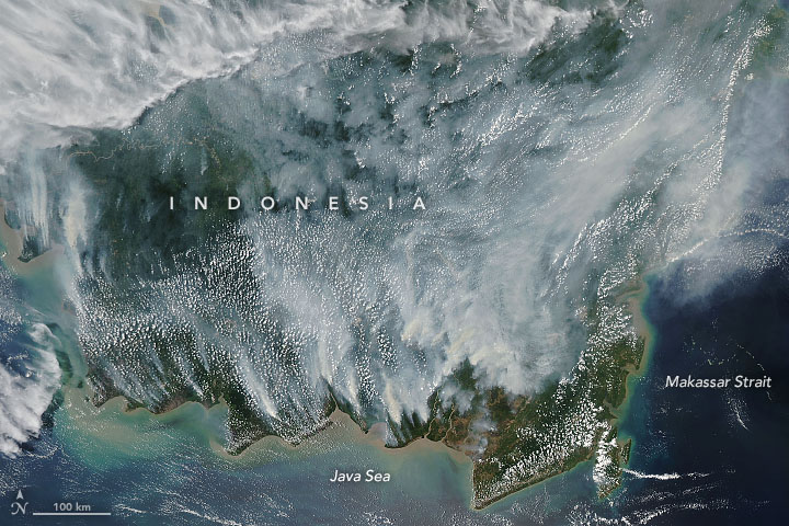
MODIS image of fires and smoke across Indonesia
The frequency of fire was 10 to 100 times lower in protected areas compared to oil palm and timber concessions. “Our work demonstrates that establishing protected areas such as National Parks is an effective way of reducing the risk of fire”, said study co-author Professor Dominick Spracklen. “Maybe surprisingly, we found that fires were also rare in logging concessions. These are areas of natural forests where selective logging is permitted. We found that the frequency of fire and rates of deforestation were similar to that in protected areas, and much lower than in oil palm and timber plantations. It demonstrates that well managed logging concessions can reduce the risk of fire”
The study identifies opportunities to manage land-use and land cover change to reduce fires in Riau. The role of protected areas and logging concessions in effectively reducing forest loss and fires needs to be recognised. Protected areas could be expanded, and combined with peatland restoration, have the potential to reduce the risk of fires in Indonesia.
Read the full study here:
Adrianto, H.A., Spracklen, D.V. and Arnold, S.R., 2019. Relationship Between Fire and Forest Cover Loss in Riau Province, Indonesia Between 2001 and 2012. Forests, 10(10), p.889.
This study was supported by the Indonesian Endowment Fund for Education and the British Council Institutional Links under the Newton Fund.